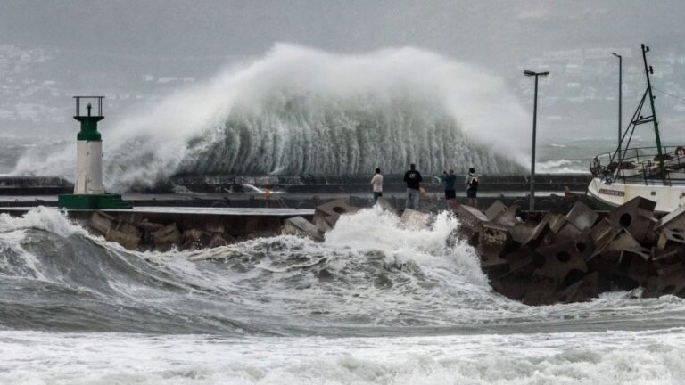
South Africa is set for a rainy and stormy start to the week, with widespread thunderstorms and potential flooding expected in several regions. According to the South African Weather Service (SAWS), weather conditions on Monday will vary from cool to warm, with heavy downpours impacting multiple provinces.
Residents are urged to stay alert as severe weather conditions could disrupt travel, damage infrastructure, and create hazardous situations, particularly in low-lying areas.
Severe Weather Warnings Issued

SAWS has issued impact-based warnings to highlight areas at risk of severe weather. These warnings are part of a colour-coded system designed to help the public understand the severity and likelihood of weather-related impacts.
Yellow Level 4 Warning
Severe thunderstorms with heavy rainfall are expected in the south-eastern parts of Mpumalanga and northern KwaZulu-Natal. These storms may lead to flooding of roads and bridges, especially in low-lying areas, along with possible damage to infrastructure due to strong winds.
Yellow Level 2 Warning
A broader region faces moderate risk, including southern Gauteng, parts of Mpumalanga, southern KwaZulu-Natal, central and eastern Northern Cape, Free State, and much of the North West. These areas may experience localized flooding, lightning, and strong winds.

In SAWS’s warning system, yellow indicates a moderate risk that requires caution. The numerical levels reflect the likelihood of impact, with higher numbers indicating greater probability of severe conditions.
Weather Conditions by Province
Gauteng
Expect cloudy skies with cool to warm temperatures and scattered showers. Morning fog is likely in the south-east.
- Pretoria: 18°C – 26°C
- Johannesburg: 16°C – 24°C
- Vereeniging: 17°C – 26°C
Mpumalanga
Cloudy conditions with early morning fog on the Highveld and widespread showers in the south-east.
- Mbombela: 19°C – 30°C
- Ermelo: 15°C – 25°C
- Emalahleni: 16°C – 26°C
Limpopo

Partly cloudy and warm with isolated showers, especially along the escarpment.
- Polokwane: 18°C – 25°C
- Musina: 22°C – 31°C
- Lephalale: 21°C – 28°C
North West and Free State
Both provinces will experience cloudy conditions with scattered thunderstorms and moderate temperatures.
- Bloemfontein: 16°C – 26°C
- Mahikeng: 17°C – 22°C
Northern Cape
The west will remain cloudy, while eastern and central areas may see isolated showers. Temperatures will range from warm to very hot.
- Upington: 22°C – 34°C
- Kimberley: 17°C – 29°C
Western Cape
Morning rain is expected in southern parts, with warmer and clearer conditions developing later in the day.
- Cape Town: 17°C – 30°C
- Vredendal: 14°C – 38°C
Eastern Cape
Cloudy with morning fog, followed by partly cloudy skies and isolated showers.
- Gqeberha: 15°C – 24°C
- East London: 18°C – 23°C
KwaZulu-Natal
Morning fog will give way to cloudy skies and widespread showers, especially later in the day.
- Durban: 23°C – 28°C
- Richards Bay: 22°C – 30°C
Potential Risks and Safety Advice
The expected weather conditions could pose several risks, particularly in areas under severe thunderstorm warnings. Flooding of roads, reduced visibility due to fog, and strong winds are among the main concerns.
Motorists are advised to drive cautiously, avoid flooded roads, and allow extra travel time. Residents in vulnerable areas should take precautions to protect property and stay informed through official weather updates.
Monday’s weather marks a turbulent start to the week, with thunderstorms, heavy rainfall, and varying temperatures across South Africa. While some regions will experience mild conditions, others face a higher risk of flooding and storm damage.
Staying informed and prepared will be essential as conditions develop throughout the day. With more unsettled weather expected, residents should remain cautious and follow safety guidelines to minimize risks.